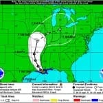
BOSTON, Sept. 16, 2013 – According to catastrophe modeling firm AIR Worldwide, Tropical Storm Ingrid had weakened from its Category 1 hurricane status by the time it made landfall near the small town of La Pesca on the eastern coast of Mexico between 6:00 and 7:00 a.m. CDT this morning. The National Hurricane Center’s 7:00 a.m. CDT Public Advisory reported that an Air Force Hurricane Hunter aircraft and radar imagery had confirmed that Ingrid had made landfall and that the storm’s wind speed had not increased in intensity as anticipated…
Read MoreTag: hurricane update
Hurricane Sandy Expected to Strike at Midnight: AIR
According to catastrophe modeling firm AIR Worldwide, As forecast, Hurricane Sandy intensified overnight and its path began to turn toward the U.S. East Coast. As of 11 a.m. EDT, Sandy has maximum sustained winds of 90 mph and is moving north-northwest at 18 mph. Although the NHC’s latest advisory indicates that Sandy’s sustained winds have achieved 90 mph, some weakening is likely to occur before landfall tonight and Sandy is expected to arrive on the south Jersey shore with winds of about 75 mph. As indicated in the National…
Read MoreHurricane Sandy slams East Coast
Hurricane Sandy makes landfall and insurers scramble to mitigate impact Hurricane Sandy has hit the East Coast of the U.S. after building in strength throughout the majority of the past week. U.S. Insurers have been working to prepare for the hurricane, which is expected to cause a significant amount of damage as it passes through densely populated cities in the northeastern region of the country. Claims teams and insurance adjusters have been mobilized to areas that are expected to see the most damage ahead of the storm in an attempt…
Read MoreTwo Landfalls by Hurricane Isaac cause Severe Flooding in Louisiana: AIR
BOSTON, Aug. 29, 2012 – According to catastrophe modeling firm AIR Worldwide, by 7:00 AM CDT this morning (8:00 AM EDT), Isaac had made two separate landfalls, both as a Category 1 hurricane. The first occurred on August 28 at low-lying Plaquemines Parish, Louisiana, at around 7:45 PM CDT. Instead of continuing inland as expected, the storm veered sharply to the southwest and re-emerged over the water, which allowed it to maintain its strength. It then made a second landfall this morning just west of Port Fourchon, Louisiana, at around…
Read MoreHurricane Isaac on Course for Louisiana Landfall
BOSTON, Aug. 28, 2012 – According to catastrophe modeling firm AIR Worldwide, Isaac has finally reached hurricane strength. Isaac is a large tropical cyclone with maximum sustained winds of about 75 mph. It is located about 75 miles south-southeast of the mouth of the Mississippi River-a region that could benefit from the rain, as the prolonged hydrological drought this year has caused the river to drop to historic lows and ground cargo ships. Isaac is also about 160 miles to the south-southeast of New Orleans, and is moving slowly northwestward…
Read More


