BOSTON, Aug. 28, 2012 – According to catastrophe modeling firm AIR Worldwide, Isaac has finally reached hurricane strength. Isaac is a large tropical cyclone with maximum sustained winds of about 75 mph. It is located about 75 miles south-southeast of the mouth of the Mississippi River-a region that could benefit from the rain, as the  prolonged hydrological drought this year has caused the river to drop to historic lows and ground cargo ships. Isaac is also about 160 miles to the south-southeast of New Orleans, and is moving slowly northwestward at about 10 mph.
Favorable wind shear conditions and warm sea surface temperature conditions, as reported by AIR’s ClimateCast Atlantic Hurricane Conditions, facilitated the intensification of the system to a category 1 hurricane. Landfall is currently forecast for somewhere along the Louisiana or Mississippi coast in the early hours of tomorrow.
“Isaac’s sustained winds have increased to 75 mph and the storm, as expected, is now a hurricane,” said Dr. Tim Doggett, principal scientist at AIR Worldwide. “Data from Hurricane Hunter aircraft indicate that maximum winds are closer to the storm’s center. These data also indicate that the storm has wobbled on a generally westward course during the past few hours, which is expected to be a temporary deviation from its northwestward movement. Isaac is expected to move into a weakness in the subtropical ridge near the north-central Gulf Coast and slow its forward speed even more during the next couple of days as a ridge builds slightly to the northwest of it. Later, it should turn northward and northwestward into the Ohio Valley region.”
“The speed has slowed, which may hold Isaac over water for an extra six to 12 hours longer than previously thought. Thus the center of the storm should come on shore about 8:00 a.m. tomorrow and push inland over New Orleans during the day. Given this track and the slow forward speed, surge into Lake Pontchartrain is still a threat, even if Isaac remains only a marginal hurricane.”
According to AIR, the majority of single-family residential structures along the U.S. Gulf Coast are of masonry construction. Since there is a possibility of Category 1 or weak Category 2 wind speeds, these structures can experience moderate damage to the roof, roof covering, with little damage to masonry walls expected. Failure of roofing components often occurs because of improper fastening between the roof system and building frame. At Category 1 wind speeds, there may also be numerous cases of damage due to downed trees, exacerbated by saturated soils, or from loose building debris such as shingles or roofing tiles. It should be noted that the vulnerability of mobile (manufactured) homes and light metal structures is much greater than that of other construction types; these buildings could experience structural damage.
According to AIR, Mobile home exposure accounts for 2% of the overall exposure in the impacted states. Engineered structures, such as reinforced concrete and steel buildings, should experience less damage compared to residential wood-frame and masonry structures; they may exhibit isolated instances of nonstructural damage, such as that to windows and roof coverings. However, damage to contents and internal finishes could result from nonstructural damage.
AIR estimates the total insured exposure (buildings) in coastal counties within Isaac’s expected impact area (within the NHC cone of uncertainty) totals USD 480 billion, or roughly 21% of the insured exposure in the three states altogether.
In addition, it is important to note that building vulnerability can change significantly through changes in building code and code enforcement, changes in material and construction practices, and structural aging. Similarly, the awareness surrounding building practices in Louisiana, Mississippi, and Alabama increased after Hurricane Katrina.
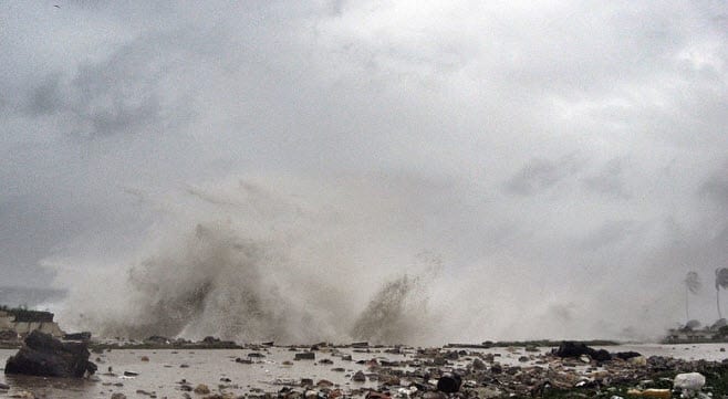
According to AIR, dangerous storm surges of up to 12 feet, heavy rainfall of up to 20 inches in areas, and strong winds are expected to extend well away from the center and to affect a large portion of the northern Gulf Coast. Heavy rainfall and flooding are also expected to spread inland over the Lower Mississippi Valley region during the next few days.
Offshore oil and gas operators in the Gulf of Mexico are evacuating platforms and rigs in the path of Tropical Storm Isaac.
AIR’s continues to monitor Isaac closely and will post additional information on the development and impacts of this storm as warranted by events.
According to AIR’s ClimateCast, the current U.S risk index is at 1.3 (out of 10). The ClimateCast(r) U.S. Hurricane Risk Index provides a real-time assessment of insured risk by making direct use of operational model forecasts of storm track and intensity. A full distribution of scenarios is run through the AIR U.S. Hurricane Model and the expected value of that distribution is indexed against the model’s exceedance probability curve. The resulting index value is reported on a scale from 0 to 10, with the confidence level quantified by the spread of the loss distribution. The higher the risk index, the higher the threat of insured loss in the U.S. Click here to view the index.
