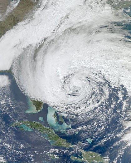
 According to catastrophe modeling firm AIR Worldwide, As forecast, Hurricane Sandy intensified overnight and its path began to turn toward the U.S. East Coast. As of 11 a.m. EDT, Sandy has maximum sustained winds of 90 mph and is moving north-northwest at 18 mph. Although the NHC’s latest advisory indicates that Sandy’s sustained winds have achieved 90 mph, some weakening is likely to occur before landfall tonight and Sandy is expected to arrive on the south Jersey shore with winds of about 75 mph.
As indicated in the National Hurricane Center (NHC) wind extent map, the impacts of tropical storm force winds have already been felt on the East Coast. The storm has impacted barrier islands off North Carolina, making several homes and businesses almost inaccessible.
“Later today, wind and surge will become more significant from Long Island Sound to Chesapeake Bay, with some of the strongest impacts being felt this evening, prior to the actual storm landfall,” said Dr. Tim Doggett, principal scientist at AIR Worldwide. “One caveat regarding the interpretation of the NHC track maps is that as Hurricane Sandy gets closer to landfall, the extent of the cone is decreasing. This reflects the increased forecast certainty in the track and is not an indication of the extent of damaging winds. For example, while New York City is not actually in the NHC cone any more, that does not mean they will not be impacted strongly by this event.”
“The NHC track forecast is still largely unchanged, and the intensity forecast is still calling for Hurricane Sandy to have hurricane force wind speeds as it makes landfall close to midnight tonight. The highest wind speeds will most likely be experienced along coastal exposures, where winds have less interaction with land and thus experience less surface friction. However, the associated area of damaging winds will be more uniform and more widespread than with a typical tropical cyclone (and extend farther inland), due to the transition of the storm to an extratropical cyclone system.”
The NHC track forecast projects landfall a little farther south along the New Jersey coast than yesterday.
Dr. Doggett concluded, “This is a subtle change and does not alter the overall expectations regarding the storm’s impacts. NHC also forecast the storm system to slow down before landfall, so it will linger over Pennsylvania longer than it was expected to yesterday. However, the greatest remaining uncertainty in the system revolves around what happens in the days after landfall. The storm’s impacts will diminish over that time, but some tropical storm force winds could linger in Washington, D.C., Philadelphia, and New York City well into Wednesday night.”
According to AIR, the entire Eastern Seaboard is bracing for Hurricane Sandy. In Delaware, hundreds of people fled to shelters, and water was already covering some roads. The public transportation system in the Washington, D.C., area has been shut down, including Metro, Virginia Railway Express, and the Maryland Transportation System. Baltimore has opened six shelters, and several city intersections are closed due to the threat of flooding.
In New York City, the evacuation of Coney Island and Lower Manhattan has been ordered. The school and subway systems have both been shut down, and floor trading on the New York Stock Exchange is closed, although the electronic system remains open. People living along Long Island Sound have also been ordered to evacuate, and any heeded the warning.
In Rhode Island, mandatory evacuations have been ordered in many communities, and many schools closed today. Flooding is expected along Narragansett Bay, which runs through the middle of the state. Residents were told to be prepared to be without power.
Thousands of flights to and from cities in the eastern part of the U.S. have been canceled, and there are predictions that as many as 10 million people could lose electricity. In Virginia, 5,000 Dominion Virginia Power customers had no power on Sunday, and it was estimated by the company that the number could rise to 1 million during the next few days.
AIR continues to monitor Sandy closely and will provide additional information on the development and impacts of this storm.
For more insurance news headlines.
