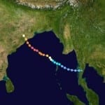
BOSTON, Oct. 15, 2013 – According to catastrophe modeling firm AIR Worldwide, around 21:15 local time (15:45 UTC) on Saturday, October 12, Very Severe Cyclonic Storm Phailin made landfall on the eastern coast of India near Gopalpur in Odisha. Phailin was a large storm, with gale force winds (>63 km/h) extending 250 km on either side and storm force winds (>93 km/h) extending 100 km on either side. Results of simulations of Phailin using the AIR Tropical Cyclone Model for India indicate that insured wind losses to onshore properties in…
Read MoreTag: storm news
Cyclone Phailin Makes Landfall in Odisha, India
According to catastrophe modeling firm AIR Worldwide, Cyclone Phailin made landfall in the Indian state of Odisha at around 9:15 p.m local time on Saturday. The massive storm, at half the size of India according to satellite imagery, is the strongest to affect the country since 1999’s Cyclone Orissa, which killed nearly 10,000 people. Phailin is accompanied by strong winds, heavy rains, and damaging waves. Extensive property and crop damage is expected in the affected region. With power and communications cut off, damage information has been scarce overnight. A more…
Read MoreHurricane Manuel Returns to Soak Northwestern Mexico: AIR Worldwide
According to catastrophe modeling firm AIR Worldwide, after rapidly dissipating on Monday night and being downgraded to a remnant tropical low, Manuel reformed and strengthened back to hurricane intensity on Wednesday. The re-formation was aided by a reduction in wind shear over the past two days, as well as by the storm having moved back over the warm ocean waters off the western coast of Mexico. Hurricane Manuel slowly drifted to the north-northwest at about 5 mph. This track, coupled with the storm’s slow forward speed, resulted in Manuel remaining…
Read MoreTropical Storm Andrea to Make Landfall in Northern Florida
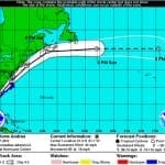
According to catastrophe modeling firm AIR Worldwide, as of the National Hurricane Center’s 11:00 a.m. advisory, Tropical Storm Andrea is moving northeastward at a speed of 15 mph with maximum sustained winds of 60 mph and some stronger gusts. Tropical storm winds extend outward 140 miles but primarily to the east of the storm’s center. The storm is expected to accelerate and continue on a northeast path later today, making landfall in Florida’s Big Bend. Andrea is not expected to intensify further before making landfall and if forecasts hold AIR…
Read MoreTropical Cyclone Rusty Makes Landfall; Brings Strong Wind Gusts
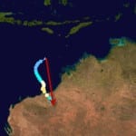
According to catastrophe modeling firm AIR Worldwide, with 1-minute sustained winds of 136 km/h and gusts to 170 km/h, Tropical Cyclone Rusty came ashore as a severe… tropical cyclone-a category 3 storm by the Australian system of cyclone classification (approximately equivalent to a category 1 storm on the U.S. Saffir-Simpson Scale). Rusty made landfall in Pardoo, which is located approximately 110 kilometers east northeast of Port Hedland. Rusty is weakening as it moves further inland, but still wind gusts of 165 km/h were expected near the center of the storm…
Read MoreTyphoon Bopha (Pablo) Impacts the Philippines: AIR Worldwide
According to catastrophe modeling firm AIR Worldwide, Super typhoon Bopha made landfall at 2100 UTC on the island of Mindanao with a central pressure of 930 mb and 10 min sustained winds of 100 kts (115 mph)). NASA-TRMM data indicate that there were maximum rainfall rates of 50-75 mm/hr at landfall. According to AIR, given that insurance penetration in this area is around 10% to 20%; insured losses are not expected to be high as a result of this event. “Bopha is a unique storm due to its intensity and…
Read MoreTropical Storm Ernesto Brings Heavy Rainfall with Second Landfall: AIR
BOSTON, Aug. 10, 2012 – According to catastrophe modeling firm AIR Worldwide, Tropical Storm Ernesto made its second landfall on Thursday, August 9 at around 1:00 PM CDT in southern part of the Mexican state of Veracruz. Wind damage is expected to be minimal, but the storm’s heavy rainfall is expected to continue throughout the day, even as the system dissipates. Significant insured losses are currently not expected from Ernesto. Interestingly, global models suggest that the remnants of Ernesto may redevelop into a tropical cyclone early next week after exiting…
Read More


