The majority of meteorologists are predicting that this year won’t be as active than 2016. The 2017 Atlantic Hurricane Season had an early beginning but meteorologists think it won’t be as active as last year. The number of hurricanes and name storms will be about average. That said, there are still a handful of meteorologists who think it will be slightly more active than normal. In fact, unlike the majority of weather experts, Global Weather Oscillations predicted that the 2017 Atlantic Hurricane Season would be the most active in the…
Read MoreTag: National Hurricane Center
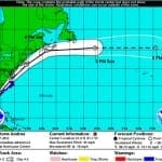
Tropical Storm Andrea to Make Landfall in Northern Florida
According to catastrophe modeling firm AIR Worldwide, as of the National Hurricane Center’s 11:00 a.m. advisory, Tropical Storm Andrea is moving northeastward at a speed of 15 mph with maximum sustained winds of 60 mph and some stronger gusts. Tropical storm winds extend outward 140 miles but primarily to the east of the storm’s center. The storm is expected to accelerate and continue on a northeast path later today, making landfall in Florida’s Big Bend. Andrea is not expected to intensify further before making landfall and if forecasts hold AIR…
Read MoreAIR Worldwide Updates Loss Estimates for Post-Tropical Cyclone Sandy
BOSTON, Nov. 26, 2012 – Since Sandy made landfall as a post-tropical cyclone on October 29, 2012, in southern New Jersey, catastrophe modeling firm AIR Worldwide has been analyzing the storm’s characteristics and impacts. Informed by the latest available information on surge height and extent from the USGS, surface wind speed observation data, and findings from AIR’s post-disaster survey teams, AIR now estimates that insured losses from Sandy will be between USD 16 and USD 22 billion. AIR estimates include wind and storm surge damage to onshore residential, commercial and…
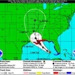
Read MoreTropical Storm Isaac Heads for the Louisiana Coastline; Intensification Is Expected
BOSTON, August 27, 2012 – According to catastrophe modeling firm AIR Worldwide, Tropical Storm Isaac has passed through the Florida Keys-where it delivered wind and rain yesterday, but caused little damage-and moved into the Gulf of Mexico; the storm is currently about 360 miles southeast of the mouth of the Mississippi River, moving west-northwest at 14 mph. Isaac’s forward speed has decreased since yesterday, while its maximum sustained winds-at 65 mph-have remained constant. “Data from Hurricane Hunter aircraft indicate that Isaac has not strengthened since yesterday, possibly because the storm…
Read MoreCitizens Property Insurance prepares for Tropical Storm Isaac
Citizens Property Insurance begins preparations for a potentially powerful storm Florida’s Citizens Property Insurance is preparing for the coming of Tropical Storm Isaac. The storm has lashed the Florida Keys, causing a modest amount of damage in the region, but is making its way further into the Gulf of Mexico. The storm is expected to make landfall, where the National Hurricane Center suggests that it could gain hurricane strength. The government agency has issued warnings stretching from Louisiana to parts of the Florida panhandle, encouraging states and consumers to prepare…
Read More


