BOSTON, Oct. 28, 2013 – According to catastrophe modeling firm AIR Worldwide, Winter storm “Christian” (known as “St. Jude” in the United Kingdom) battered the western shores of southern Great Britain early on Monday, October 28, 2013, as one of the strongest extratropical cyclones to affect the region in perhaps a decade. When it reached Britain’s southern shores, the storm was packing winds of 130 km/h (80 mph) and caused waves exceeding 7.5m (25 feet). About 270,000 homes in Britain and 75,000 in France lost power. Rail, sea, and air…
Read MoreTag: storm watch
Severe Cyclone Phailin Could be Worst Cyclone in 14 Years
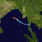
BOSTON, Oct. 11, 2013 – According to catastrophe modeling firm AIR Worldwide, currently several hundred kilometers off of the eastern coast of India, Very Severe Cyclonic Storm Phailin is expected to make landfall on Saturday evening, local time, north of the city of Visakhapatnam. The storm is expected to severely impact areas in the states of Odisha and Andhra Pradesh. AIR expects significant damage from this event. Heavy to very heavy rainfall over large areas of Andhra Pradesh and Odisha, along with extremely heavy rainfall in some areas, will likely…
Read MoreTropical Storm Andrea to Make Landfall in Northern Florida
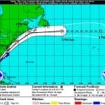
According to catastrophe modeling firm AIR Worldwide, as of the National Hurricane Center’s 11:00 a.m. advisory, Tropical Storm Andrea is moving northeastward at a speed of 15 mph with maximum sustained winds of 60 mph and some stronger gusts. Tropical storm winds extend outward 140 miles but primarily to the east of the storm’s center. The storm is expected to accelerate and continue on a northeast path later today, making landfall in Florida’s Big Bend. Andrea is not expected to intensify further before making landfall and if forecasts hold AIR…
Read MoreCleanup of Fierce Northeast Winter Storm Begins: AIR Worldwide
BOSTON, Feb. 11, 2013 – According to catastrophe modeling firm AIR Worldwide, from New York 500 miles north to Maine and then into Canada, the fierce February 8-9 winter snow storm brought deep snow, high gusting winds, and significant storm surge along the New England coast. An estimated 40 million people have been affected and as of early Monday, there were no reports of substantial structural damage. “The storm developed late Thursday and in the early hours of Friday when a strong coastal disturbance that had developed along the Delmarva…
Read MoreNortheast Braces for Blizzard Tomorrow: AIR Worldwide
BOSTON, Feb. 7, 2013 – According to catastrophe modeling firm AIR Worldwide, a disturbance tracking across the Great Lakes is expected to merge later tonight with another low pressure system developing off the Mid-Atlantic Coast. The combined system is forecast to pass to the south of Cape Cod and then intensify rapidly. By Friday evening, heavy snow is expected to fall across southern New England, and by Saturday morning winds are expected to be very intense for coastal New England. “Convective (thunderstorm) activity embedded within the system could result in…
Read More


