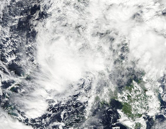
 According to catastrophe modeling firm AIR Worldwide, Tropical Storm Washi pummeled the northern part of the Philippine island of Mindanao late Thursday night. Heavy rainfall from Washi (locally called Sendong) lasted for ten hours, after which flash flooding caused rivers to overflow and coastal cities to flood. In some locations of Mindanao, as much as 20 centimeters of rain fell within a 24 hour period-roughly four times as much rainfall as the region typically receives in the whole of December. In isolated locations, the storm delivered up to 50 millimeters of rainfall per hour-about 10 to 20 millimeters more than had been predicted by the region’s local weather agency.
Washi made landfall in northern Mindanao, which produces rice (the Philippines’ staple food). Northern Mindanao is also home to pineapple and banana plantations. According to the Philippine Agriculture Secretary, damage to the farm sector from Washi is still being assessed, but it is estimated that nearly 4,000 hectares of rice and corn land were impacted.
“Washi made landfall as a tropical storm at approximately 09:00 UTC on December 16th (roughly 5pm local time). Maximum sustained winds at landfall were 74 kilometers per hour (46 miles per hour), making Washi a weak tropical storm,” said Dr. Peter Sousounis, senior principal scientist at AIR Worldwide. “Its maximum sustained winds never exceeded 46 mph during its lifetime. The storm’s most significant threat was precipitation; even prior to making landfall, Washi’s outer rain bands brought heavy rainfall to Mindanao’s northeast coast.
According to AIR, Washi’s tropical storm-strength winds are expected to have caused limited damage to roof and wall claddings of poorly constructed homes and commercial structures, and very little damage to well-built structures, though the storm is expected to have caused significant damage to low-rise buildings from precipitation-induced flooding. As flood insurance penetration in the hardest hit regions are low, AIR does not expect significant insured losses from this event.
As of the Japan Meteorological Agency’s (JMA) 6:40 UTC advisory today, Washi is a tropical depression, east of the Philippines, in the South China Sea.
Though the Philippines is regularly battered by cyclones that form over the Pacific Ocean, northern Mindanao is unaccustomed to tropical cyclone activity. (Storms typically track farther north). Officials said they had never witnessed anything like Washi. Washi is the 10th typhoon to hit Philippines this year.
Tropical Storm Washi’s general movement to the west is forecast to continue today. The Malaysian Meteorological Department said in a statement Monday the storm was moving westwards from Palawan, Philippines, towards East Malaysia. Malaysia’s east coast could experience waves of more than 5.5 meters high until Saturday. According to the National Disaster Risk Reduction and Management Council, Tropical Storm Washi has affected more than 167,000 people.
The damage picture from Washi is still emerging at this time, but it is clear that the port cities of Cagayan de Oro and Iligan were most severely impacted. There have been reports of disrupted power lines and flooded streets.
AIR continues to monitor the situation and will provide information if changes occur
