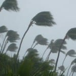
BOSTON, July 3, 2014 – According to catastrophe modeling firm AIR Worldwide, Arthur officially became a hurricane at about 5 a.m. EDT today… when maximum sustained winds of 75 mph and central pressure of 985 mb were reported by Hurricane Hunter aircraft and NOAA Doppler radar. At that time the storm was located some 190 miles (305 km) southwest of Cape Fear, North Carolina, but the track of the storm has since begun to shift a little to the northeast and its forward speed has increased slightly. According to the…
Read MoreTag: storm news
Northern Europe Cleans Up After Extratropical Cyclone Xaver: AIR
BOSTON, Dec. 10, 2013 – According to catastrophe modeling firm AIR Worldwide, last week, Extratropical Cyclone Xaver affected large parts of northern Europe, particularly the United Kingdom, Northern Ireland, Germany, the Netherlands, Belgium, Denmark, southern Sweden, Poland, and the Czech Republic. Xaver followed approximately five weeks after Windstorm Christian battered Denmark, Germany, the Netherlands, France, UK, and Sweden in late October. AIR estimated insured losses of between EUR 1.5 billion and EUR 2.3 billion from Christian. “Hurricane-force winds caused widespread power outages and travel disruptions throughout the region, but the…
Read MoreExtratropical Cyclone Xaver Moves Slowly Across Europe with Powerful Winds and Storm
BOSTON, Dec. 6, 2013 – According to catastrophe modeling firm AIR Worldwide, Extratropical Cyclone Xaver has moved across Germany, the Netherlands, Denmark, and Poland. Wind speeds were recorded at 158 km/h when the storm reached Germany and heavy winds affected the Netherlands, Poland, and parts of Scandinavia. Massive storm surges have occurred along the coasts of southeastern England, the Netherlands, and northern Germany. “Xaver developed off the coast of Greenland on December 4, 2013 and its development was enhanced by another low-pressure system, Wilhelm, which was located over the Norwegian…
Read MoreCatastrophic Destruction in the Central Philippines from Wind, Surge in Typhoon Haiyan’s Wake: AIR Worldwide
According to catastrophe modeling firm AIR Worldwide, in the three days since Super Typhoon Haiyan roared through the central Philippines, the scale of the devastation revealed in its wake continues to escalate. Preliminary analyses suggest that Haiyan (named Yolanda in the Philippines) may have been the strongest storm to make landfall anywhere in the world in recorded history. With sustained winds estimated at 315 km/h (196 mph) at its first landfall, according to the Joint Typhoon Warning Center (JTWC), the storm maintained impressive wind speeds as it traversed the Philippines.…
Read MoreOne of the Most Powerful Typhoons Ever Recorded Strikes Philippines
According to catastrophe modeling firm AIR Worldwide, Super Typhoon Haiyan, one of the most powerful tropical cyclones since modern record-keeping began, made landfall at 5:00 a.m. local time on November 8, 2013 (21:00 UTC on November 7) near Guiuan, on the Philippine island of Samar. At that time, the Japan Meteorological Agency (JMA) estimated a minimum central pressure of 895 millibars and maximum 10-minute sustained wind speeds of 266 km/h (165 mph). The Joint Typhoon Warning Center estimated maximum sustained wind speeds of 305 km/h (190 mph). According to AIR, since…
Read More


