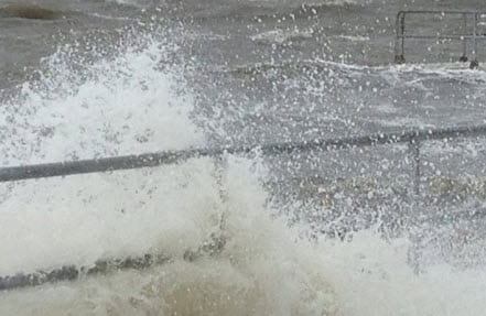
BOSTON, Oct. 15, 2013 – According to catastrophe modeling firm AIR Worldwide, Tokyo is bracing itself for its strongest typhoon since October 2004. Wipha, the eighth typhoon of 2013 and the 26th named tropical cyclone of the year, is a huge storm system currently moving northeastward toward Japan. It will likely follow the coast and pass close to Tokyo around the morning rush hour on Wednesday, bringing with it powerful winds and heavy rain.
According to the Japan Meteorological Agency (JMA), as of 14 UTC on October 15, Typhoon Wipha is located at 31.1°N and 137.0°E and is moving quickly to the NE at ~45 km/h (29 mph). Wipha is a large typhoon, with minimum central pressure of 955 mb and maximum 10-minute sustained wind speeds of 129 km/h (80 mph).
“Wipha is tracking around the western periphery of a high pressure system located to its east and is also feeling the influence of a trough approaching from the west, which together will continue to steer the storm and lead to an acceleration in forward speed,” said Dr. Kevin Hill, atmospheric scientist, AIR Worldwide.
“Interaction with the trough and increasing mid-latitude temperature gradients and wind shear will cause Wipha to rapidly transition to a potent extratropical cyclone.”
The JMA is forecasting gradual weakening along with an increase in forward speed, as Wipha continues to track to the NE or NNE. Wipha is forecast to make landfall or graze the coast of eastern Chiba Prefecture at approximately 21 UTC on October 15, passing within about 75 km to the east of Tokyo with maximum sustained wind speeds of 129 km/h (80 mph). The JMA forecast indicates that by the time Wipha is located east of Sendai, at 06 UTC on the following day, the storm will have lost all its
tropical characteristics, although it will still be capable of producing strong winds and heavy precipitation as a strong extratropical cyclone.
Dr. Hill continued, “Heavy rainfall is occurring in advance of the storm throughout a large portion of Japan, with 24-hour rainfall totals already exceeding 150 mm (6 in) in portions of Chiba Prefecture. Heavy rainfall will continue as the storm approaches, although it’s fairly rapid forward speed will serve to reduce
precipitation totals. Wind speeds of greater than 54 km/h (36 mph) are being reported over portions of the country and should continue to increase as the storm approaches.”
“Japan has strict and well-enforced construction codes and because it regularly experiences extreme precipitation and flooding, it continues to invest heavily in flood defenses,” said Dr. Cagdas Kafali, principal research engineer, AIR Worldwide. “These include the world’s largest underground flood water diversion facility, designed to protect Tokyo from flooding by channeling the overflowing flood waters
from its rivers through tunnels to five huge underground silos.”
Dr. Kafali continued, “At the expected wind speed levels, non-engineered structures may experience some roof covering damage. Some poorly constructed wood frame homes may experience moderate damage, involving loss of the roof covering as well as the removal of porch coverings and awnings. Masonry homes and well- constructed wood-frame homes could have minor damage to roof covering (tiles or shingles), wall siding, soffit panels, and gutters. Some poorly built and not well maintained industrial buildings can lose roofing and siding especially from windward corners, rakes, and eaves. For engineered structures, structural damage is not expected.”
Dr. Hill concluded, “The storm’s precipitation footprint is extremely large, and even if Wipha remains centered over the ocean, heavy rain will reach the higher terrain of inland Japan. Regions along the east coast from Osaka to Fukushima (site of the Fukushima Daiichi nuclear plant) are likely to experience widespread flooding and the threat of mudslides. Damaging winds will impact the coast also, leading to
downed trees, widespread power outages, and some structural damage.”
According to AIR, typhoons are the most frequent cause of property loss in Japan, and while winds are the predominant driver of loss, the country regularly experiences “wet” storms that deliver extreme precipitation and flooding that contribute substantially to damage.
In Japan, wind damage is typically automatically covered under standard fire insurance policies, but flood damage is not. Property owners who want flood coverage can purchase it as an add-on to a standard policy or they can select a comprehensive policy. Take-up rates for flood are relatively low.
AIR will continue to monitor this storm closely and will post additional information if necessary.

