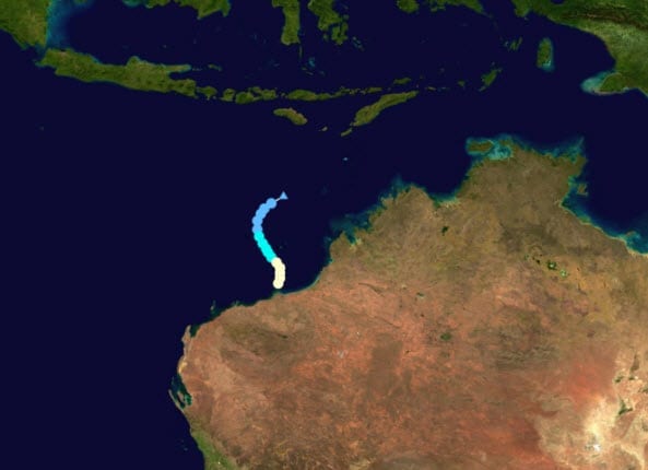
 According to catastrophe modeling firm AIR Worldwide, Tropical Cyclone Rusty formed only on Saturday, February 23, but grew rapidly and intensified due to…
low wind shear (5-10 knots) and very warm waters off the northwestern coast of Australia (31-32° C). It is expected to intensify further as it approaches the coast as the upper level environment remains highly conducive for development. Rusty is expected to make landfall near Port Hedland around 6 p.m. WST on Wednesday Feb. 27 (5 a.m. EST, Wednesday 2/27) as a severe tropical cyclone-a Category 4 storm by the Australian system of cyclone classification (approximately equivalent to a Category 3-4 storm on the U.S. Saffir-Simpson Scale). At this time, significant insured losses are not expected from this event, primarily because of the regions stringent building codes.
“Tropical Cyclone Rusty, a huge, powerful and very slow-moving system, is poised to strike the Pilbara coast in Western Australia,” said Dr. Peter Sousounis, senior principal atmospheric scientist at AIR Worldwide. “Very destructive 10-minute sustained winds of up to 165 kph with gusts near 200 kph will hit the coast well before the eye of the storm makes landfall to the east of Port Hedland. Even though Port Hedland is expected to be on the right-hand side of the storm, because of the clockwise rotation of cyclones in the southern hemisphere, it will be on the weak wind side.”
Dr. Sousounis continued, “The slow movement is a concern from a flooding standpoint, as satellite derived rainfall estimates over open water have been on the order of 200-300 mm. Thus, as well as wind damage, the heavy rain associated with the storm is likely to cause flooding as the system proceeds inland. Also, Rusty’s intensity, size and slow movement will also likely lead to a dangerous storm tide and damaging waves resulting in coastal flooding. Port Hedland in particular is vulnerable to storm surge-even a weak to moderate cyclone close to high tide can cause significant inundation, such as that experienced in 1939.”
According to AIR, Australia’s cyclone season runs from mid-December to April, and peaks in February. Tropical cyclones tend to occur far more frequently near the northern half of the continent, and the Pilbara coast is impacted more than any other part of Australia-experiencing an average of about one cyclone every two years. Since 1910, Port Hedland has experienced gale-force winds from 49 cyclones, seven of which caused destructive gusts in excess of 170 km/h. Cyclone Joan produced the strongest gusts ever recorded at Port Hedland (208 km/h) in 1975.
According to AIR, because it experiences so many tropical cyclones, the area is well prepared to cope with them through stringent building codes and effective response plans. Australian building standards divide the country into four wind speed zones, of which region D covers this small portion of the western coastline where stronger storms typically impact most frequently. New Wind Design Guidelines were phased in throughout the country between 1976 and 1985. The most destructive tropical cyclone to strike the area since Joan in 1975 was George, which delivered wind gusts estimated to have reached around 200 km/h in March 2007. In the Port Hedland area most residential and commercial structures performed well, and structural damage was sustained by fewer than 2% of buildings, most of which proved to have weaknesses due to poor maintenance.
Most of Australia’s residential buildings are single family homes, either wood frame or masonry, with many having brick veneer. The ratio of wood to masonry buildings varies by region, with masonry being more likely in Western Australia. Residential roofing is typically metal, and is the principal source of wind damage in many cases. Port Hedland has a number of trailer (caravan) parks for visitors and residents, and these are particularly vulnerable to damage.
According to AIR, the commercial and industrial building stock in Australia is predominantly concrete and steel, with concrete making up about 60% of commercial/industrial stock across the country. Prior to most storms on the Western Australia coast, these facilities usually secure their structures and contents from damage. However, commercial and industrial buildings constructed of light metal framing will be the most susceptible to significant wind damage.
Dr. Sousounis concluded, “As well as damage to structures along the coast and well inland caused by its high winds, Tropical Cyclone Rusty’s slow progress and unusually heavy rains will lead to flooding inland along major river systems. Flood warnings have been issued for De Grey River catchment and West Kimberley, including Cape Leveque.”
