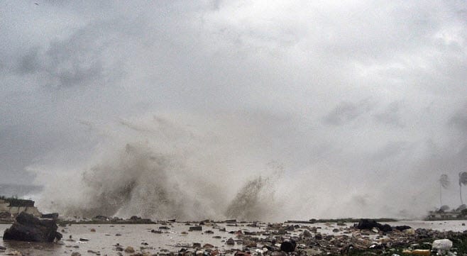
BOSTON, Aug. 30, 2012 – According to catastrophe modeling firm AIR Worldwide, by 1:00 p.m. CDT this afternoon, August 30, Tropical Storm Isaac was continuing to move slowly northwestward over northern Louisiana producing heavy rains, gusty winds, and high water levels along the northern Gulf coast. The storm, which remains very large, slowly continues to weaken. However, 36 hours after initial landfall, maximum sustained winds as reported by the National Hurricane Center (NHC) are still 40 mph. The storm is expected to continue weakening gradually and it will likely be downgraded to a tropical depression by this evening.
“Isaac is expected to continue to produce heavy rainfall, which could result in significant lowland flooding,” said Dr. Tim Doggett, principal scientist at AIR Worldwide. “Whether this will alleviate the drought conditions that exist over much of the region will depend on how fast the rain falls; too fast and the soil will be unable to absorb it.”
“As of 1:00 p.m. CDT, the center of the storm was 25 miles southwest of Monroe, Louisiana, heading north-northwest at 9 mph. Central pressure has risen to 992 mb. Louisiana continues to be pelted with heavy rainfall along with gusty winds. Flooding and storm surge warnings remain in effect. Total rainfall accumulations of 7 to 14 inches are expected, with up to 25 inches in some locations.”
Damage reports have mostly been focused on the flooding caused by Isaac’s precipitation shield and slow movement. 7.86 inches of rain were reported at the New Orleans International Airport yesterday. Much of the worst flooding occurred in Plaquemines Parish, Louisiana, where a combination of storm surge and rainfall caused water to top the earthen levees. Up to 12 feet of standing water was reported in parts of Plaquemines Parish yesterday, where as many as 800 homes are reported to have sustained significant water damage.
Meanwhile, storm surge values near Lake Pontchartrain are still near the 6 foot mark, with 5 feet of surge measured in Waveland, Mississippi. It is estimated that more than 900,000 customers are currently without power across five states.
Dr. Doggett continued, “Isaac’s slow forward speed and refusal to dissipate will exacerbate the amount of wind damage. As the winds persist, roof fasteners and connections can become fatigued and overloaded causing additional damage, and the possibility of damage from flying building debris persists.”
“It should also be noted that with soils heavily saturated by rain, trees can be downed by much lower wind speeds than would otherwise be necessary.”
Downed power lines, trees and other infrastructure are being reported over much of southern Louisiana and Mississippi. Some structural damage is being reported in New Orleans and the surrounding area, mostly limited to roof damage and to non-structural elements such as awnings, signage, and trailers.
Although Isaac has battered properties on the U.S. Gulf Coast for more than 36 hours, government officials have not reported any discernible damage to offshore oil and gas platforms. According to the Bureau of Safety and Environmental Enforcement (BSEE), some 505 platforms (about 85% of the total in the Gulf) and 50 rigs (about 66% of the total) had been evacuated.
Dr. Doggett concluded, “Isaac weakened to a tropical storm yesterday afternoon and is forecast to become a tropical depression by tonight. It is expected to continue its slow northwestward progression at least until the system is downgraded. The high pressure along the east coast that will start to steer the system to the north and northeast is still building, and will not affect Isaac’s track until later in the day tomorrow, by which time its center will be over Arkansas. It is expected to be over southern Missouri Friday night.”
AIR continues to monitor Isaac’s slow progress and will provide additional updates as warranted by events.
