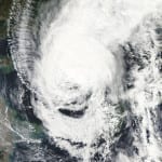
According to catastrophe modeling firm AIR Worldwide, Typhoon Usagi, a Category 3 storm with maximum sustained winds of 204 km/h (10 minute wind speed as reported by the Japan Meteorological Agency), is expected to strengthen over the coming days and could become the first Category 5 storm of 2013. The storm is currently located several hundred miles off the coasts of both the northern Philippine island of Luzon and Taiwan and is gathering strength as it moves northwest. Usagi, which is called Odette in the Philippines, is expected to deliver…
Read MoreTag: typhoon news
Typhoon Nalgae on Course to Hit the Philippines
BOSTON, Sept. 30, 2011 — According to catastrophe modeling firm AIR Worldwide, Typhoon Nalgae (named “Quiel” by the Philippines state weather bureau, PAGASA) formed on September 24 east of Guam from an area of convection with a weak low-level circulation center. Over the next several days, Nalgae became better organized under moderate vertical wind shear and high sea surface temperatures of 29°C-30°C. It strengthened to tropical storm strength and was named by the Japan Meteorological Agency (JMA) on September 26. Nalgae is the nineteenth named tropical cyclone of the 2011…
Read MoreTropical Storm Nanmadol Poised for China Landfall after Battering Taiwan and Philippines
BOSTON, Aug. 30, 2011 – According to catastrophe modeling firm AIR Worldwide, Tropical Storm Nanmadol is moving slowly at about 3.2 km/h across the Taiwan Strait toward a landfall in China’s Fujian province sometime in the next 12 hours. Nanmadol’s current sustained winds are at about 85 km/h, having weakened to tropical storm strength after it made a landfall on southernmost Taiwan early Monday morning local time as a Category 1 typhoon. Nanmadol currently is heading toward Xiamen, Fujian’s second-largest city (population 1.5 million, 2010). As of the Japan Meteorological…
Read MoreTyphoon Muifa Misses China’s East Coast, Lands in North Korea as Tropical Storm
BOSTON, Aug. 8, 2011 – According to catastrophe modeling firm AIR Worldwide, Muifa, once a super typhoon with winds exceeding 250 km/h (1-min sustained), made landfall near the border between China and North Korea around 12:00 UTC Monday at tropical storm strength. Last week, the storm had been forecast to make landfall over the weekend near Shanghai. However, Typhoon Muifa turned to the north earlier than expected and bypassed China’s eastern coastal provinces. Muifa weakened to a tropical storm as it entered the East China Sea and passed to the…
Read MoreTyphoon Ma-On Nears Japan
BOSTON, July 18, 2011 – According to catastrophe modeling firm AIR Worldwide, with winds gusting to 157 kilometers per hour (98 miles per hour), Category 2 Typhoon Ma-On (local name “Ineng”) has passed Minami Daito Island and is moving at about 19 kph (12 mph) toward the north. Currently about 885 kilometers (550 miles) southwest of Tokyo, Ma-On is expected to stay at its current intensity for the next 24 hours and make landfall on Shikoku Island Tuesday morning local time. Ma-On is a large storm with typhoon force winds…
Read More
