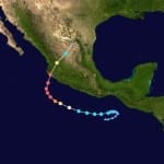
Despite the fact that it was the most powerful storm ever seen by the Western Hemisphere, it was not the most damaging. The first reports about Hurricane Patricia that were released over the weekend after the storm made landfall on the west coast of Mexico indicated that there had not been any major damage and that there had not been any deaths. The early reports were cautiously optimistic that the broad efforts to evacuate affected areas saved lives. Even though Hurricane Patricia was the most powerful storm of that nature…
Read MoreTag: tropical storm
Typhoon Wipha Causes Flooding and Mudslides in Izu Oshima before Dissipating: AIR
BOSTON, Oct. 16, 2013 – According to catastrophe modeling firm AIR Worldwide, although Typhoon Wipha did not make landfall on Japan’s main island of Honshu today,as had been expected, the storm brought soaking rain and gusty winds to much of both Honshu and Hokkaido, including the Tokyo region, which experienced a total of 150-300 mm (6-12 inches) of rain. Tokyo International Airport reported some of the highest sustained wind speeds in Japan from this storm: 79 km/h (49 mph) 10-min sustained and a 116 km/h (72 mph) gust. However, Tokyo…
Read MoreTyphoon Nari Makes Landfall South of Baler, Luzon, in the Philippines
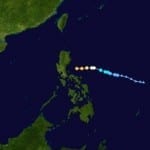
BOSTON, Oct. 11, 2013 – According to catastrophe modeling firm AIR Worldwide, as of 18:50 October 11, 2013 UTC (2:50 October 12, 2013 PHT; 14:50 October 11, 2013 EDT), Typhoon Nari (Santi) made landfall just south of Baler, Luzon, as a Category 1 storm with a central pressure of 975 mb, sustained (10-minute) wind speeds of 120 km/h, and gusts reaching 176 km/h. A radius of 93 km/h winds extends 90 km from the storm’s center. This area is sparsely populated; the only communities in the vicinity are Baler and…
Read MoreTropical Storm Gabrielle Buffets Bermuda, First Hurricane of 2013 Season Forms: AIR
BOSTON, Sept. 11, 2013 – According to catastrophe modeling firm AIR Worldwide, one day after regenerating into a tropical storm after fizzling in the Caribbean last week, Gabrielle’s center came within 65 km (40 miles) west-southwest of Bermuda this morning. As of the National Hurricane Center’s (NHC) 11 a.m. AST advisory today, Gabrielle was about 90 km (55 miles) west of Bermuda and has moved little over the past few hours. “The storm’s maximum sustained winds weakened to 80 km/h (50 mph), although tropical storm force wind gusts could continue…
Read MoreTropical Storm Andrea to Make Landfall in Northern Florida
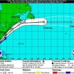
According to catastrophe modeling firm AIR Worldwide, as of the National Hurricane Center’s 11:00 a.m. advisory, Tropical Storm Andrea is moving northeastward at a speed of 15 mph with maximum sustained winds of 60 mph and some stronger gusts. Tropical storm winds extend outward 140 miles but primarily to the east of the storm’s center. The storm is expected to accelerate and continue on a northeast path later today, making landfall in Florida’s Big Bend. Andrea is not expected to intensify further before making landfall and if forecasts hold AIR…
Read More


