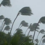
According to catastrophe modeling firm AIR Worldwide, Super Typhoon Haiyan, one of the most powerful tropical cyclones since modern record-keeping began, made landfall at 5:00 a.m. local time on November 8, 2013 (21:00 UTC on November 7) near Guiuan, on the Philippine island of Samar. At that time, the Japan Meteorological Agency (JMA) estimated a minimum central pressure of 895 millibars and maximum 10-minute sustained wind speeds of 266 km/h (165 mph). The Joint Typhoon Warning Center estimated maximum sustained wind speeds of 305 km/h (190 mph). According to AIR, since…
Read MoreTag: rainfall
Hurricane Jova Makes Landfall on Mexico’s Southwest Pacific Coast; Has Since Decreased to Tropical Storm Strength
BOSTON, Oct. 12, 2011 – According to catastrophe modeling firm AIR Worldwide, Hurricane Jova made landfall as a Category 2 storm in a sparsely populated stretch of the Mexican state of Jalisco, near the town of Chamela at 23:00 local time yesterday (6:00 UTC today). Maximum sustained winds at landfall were nearly 100 mph, as originally forecast. High waves and heavy rain were also reported. “Today, Jova’s most significant threat is that from precipitation; even prior to making landfall, Jova’s outer rain bands brought heavy rainfall to Mexico’s southwest coast,”…
Read MoreTropical Storm Don Advances Toward Texas Coast Past Oil Platforms
BOSTON, July 28, 2011- According to catastrophe modeling firm AIR Worldwide, Tropical Storm Don is moving across the southern Gulf of Mexico toward the Texas coast near Corpus Christi, where it is expected to make landfall sometime late Friday or early Saturday. The storm will pass near several areas where offshore oil production is conducted, and several petroleum companies have begun evacuating support workers. A tropical storm warning is in effect for the Texas coast from Port Mansfield north to San Luis Pass. Tropical Storm Don officially became a tropical…
Read More
