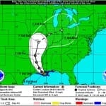
BOSTON, Aug. 29, 2012 – According to catastrophe modeling firm AIR Worldwide, by 7:00 AM CDT this morning (8:00 AM EDT), Isaac had made two separate landfalls, both as a Category 1 hurricane. The first occurred on August 28 at low-lying Plaquemines Parish, Louisiana, at around 7:45 PM CDT. Instead of continuing inland as expected, the storm veered sharply to the southwest and re-emerged over the water, which allowed it to maintain its strength. It then made a second landfall this morning just west of Port Fourchon, Louisiana, at around…
Read MoreTag: hurricane news
Hurricane Isaac on Course for Louisiana Landfall
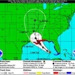
BOSTON, Aug. 28, 2012 – According to catastrophe modeling firm AIR Worldwide, Isaac has finally reached hurricane strength. Isaac is a large tropical cyclone with maximum sustained winds of about 75 mph. It is located about 75 miles south-southeast of the mouth of the Mississippi River-a region that could benefit from the rain, as the prolonged hydrological drought this year has caused the river to drop to historic lows and ground cargo ships. Isaac is also about 160 miles to the south-southeast of New Orleans, and is moving slowly northwestward…
Read MoreHurricane Isaac may make its way to Mississippi
Isaac matures into a hurricane and Mississippi prepares for storm’s arrival Tropical Storm Isaac has matured into a full-fledged hurricane as it made landfall in Florida early Monday. According to Florida’s Citizens Property Insurance, more than 300 claims have been generated by the storm already, with many more expected in the coming days. Isaac’s path is expected to continue well beyond Florida, reaching as far as Mississippi, where that state’s Department of Insurance is taking the time to remind homeowners to take caution before evacuating their property if such action…
Read MoreTropical Storm Isaac Heads for the Louisiana Coastline; Intensification Is Expected
BOSTON, August 27, 2012 – According to catastrophe modeling firm AIR Worldwide, Tropical Storm Isaac has passed through the Florida Keys-where it delivered wind and rain yesterday, but caused little damage-and moved into the Gulf of Mexico; the storm is currently about 360 miles southeast of the mouth of the Mississippi River, moving west-northwest at 14 mph. Isaac’s forward speed has decreased since yesterday, while its maximum sustained winds-at 65 mph-have remained constant. “Data from Hurricane Hunter aircraft indicate that Isaac has not strengthened since yesterday, possibly because the storm…
Read MoreTropical Storm Debby, Stalled in the Gulf of Mexico, Threatens Florida
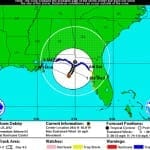
BOSTON, June 25, 2012 – According to catastrophe modeling firm AIR Worldwide, Tropical Storm Debby is the fourth named storm of the 2012 Atlantic hurricane season, currently has maximum sustained winds of 50 miles per hour and a minimum central pressure of 993 millibars, making it a weak tropical storm on the Saffir-Simpson Hurricane Wind Scale. Debby was about 105 miles south of Panama City (population 36,484), as of the National Hurricane Center’s (NHC) 7:00 am advisory today. The center is currently stationary in the Gulf of Mexico, and Debby…
Read More


