BOSTON, Oct. 16, 2013 – According to catastrophe modeling firm AIR Worldwide, at 8:12:32 Tuesday morning (UTC), a magnitude 7.1 earthquake struck the central Philippines. The epicenter was located about 619 kilometers south southeast of Manila near the city of Catigbian on Bohol Island. The quake struck at a depth of 20 kilometers and caused widespread damage. The early morning timing of Tuesday’s temblor combined with the closure of schools and offices due to a national holiday likely mitigated the quake’s deadly impact. However, there are still many reports of…
Read MoreTag: damage from earthquake
Strong M7.7 Earthquake Strikes Remote Region of Southern Pakistan
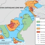
BOSTON, Sept. 24, 2013 – According to catastrophe modeling firm AIR Worldwide, at 7:29 a.m. Eastern time (4:29 p.m. local time), a magnitude 7.7 earthquake struck southern Pakistan. The epicenter was located 69 km (43 miles) north-northeast of Awaran in the province of Balochistan. The quake struck at a depth of 20.0 kilometers and was followed minutes later by a M5.9 aftershock. The USGS issued a red alert for this temblor, meaning that high casualties and widespread damage are probable. Rescue efforts have begun in full force with Balochistan officials…
Read MoreEarthquake Strikes Offshore of Wellington, New Zealand: AIR Worldwide
BOSTON, July 22, 2013 – According to catastrophe modeling firm AIR Worldwide, On July 21, 2013, at 17:09 local time (05:09, UTC), an M6.5 earthquake struck New Zealand’s Cook Strait, 54 km SSW of the capital city of Wellington, at a depth of 14 km. According to officials, there was no risk of a tsunami. Shaking, which lasted a full minute, was felt as far away as Auckland, which lies 640 km north of Wellington. Due to New Zealand’s stringent building codes and the moderate magnitude of the event, AIR does not…
Read MoreM6.2 Earthquake Strikes Taiwan Late Sunday Night: AIR Worldwide
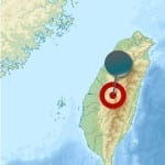
According to catastrophe modeling firm AIR Worldwide, a magnitude 6.2 earthquake struck central Taiwan Sunday night June 2, 2013, at 9:43 p.m. local time (13:43 UTC), in a sparsely populated region of Nantou County just seven kilometers (4.3 miles) northeast of a similar rupture only two months ago (M6.0 on March 27). The epicenter of the Sunday night quake was located at 23.794oN, 121.082oE, by the United States Geological Survey and estimated to be at a depth of 20 km. AIR does not expect significant insured losses from this event…
Read MorePowerful M7.8 Earthquake Strikes Iran-Pakistan Border
According to catastrophe modeling firm AIR Worldwide, just after 3:00 p.m. local time (10:44 UTC) on April 16, a powerful M7.8 earthquake struck… a sparsely populated area of southeastern Iran about 50 kilometers (30 miles) from the country’s border with Pakistan. According to the United States Geological Survey (USGS), the earthquake struck at a depth of 82 kilometers (51 miles). The Iranian Seismological Center characterized the quake as the worst to strike the country in 40 years. It was felt as far away as New Delhi, India, and the…
Read More


