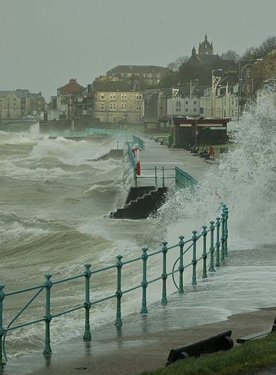
 According to catastrophe modeling firm AIR Worldwide, a red alert has been issued for winds in Scotland by the Met Office, indicating that “widespread structural damage” was likely; flood alerts for 12 rivers and lakes in Cumbria were issued; and the Government issued its first winter Health Alert for England, alerting hospitals to prepare for increased activity.
“Windstorm Friedhelm began as a depression over the northern Atlantic, but as it approached the British Isles, it experienced a rapid drop of pressure that caused its wind speeds to soar, reaching in places the maximum of ‘Force 12’ on the Beaufort scale,” said Dr. Gerhard Zuba, senior principal scientist at AIR Worldwide. “This kind of rapid deepening of a low pressure system-when pressure falls by as much as 24 millibars within 24 hours-is also known as a ‘weather bomb.’ In Friedhelm’s case the pressure dropped by 44mb as it approached land, eventually hitting a low of just 944mb on Thursday at midday.”
According to AIR, residential building stock in Scotland is predominantly of masonry construction. For commercial exposures, however, the construction type is approximately 50% masonry with the remaining construction split between steel frame and reinforced concrete. Little structural damage to these construction types is expected for windspeeds of the order widely experienced from Friedhelm, although damage to cladding, signage, and some isolated roof covering damage could occur.
Reports of structural damage are few at present level of damage is not expected to be severe. While structural damage may be low, reports of minor superficial damage to cladding, store display windows, and signs have been common. Power outages, however, were extensive, with an estimated 70,000 homes losing power during the storm-roughly two thirds of which (50,000 homes) are still without electricity.
Dr. Zuba continued, “Satellite imagery indicates the occurrence of a sting jet, a localized strong downdraft that can develop on the southern flank of an extratropical cyclone and bring cold, dry air from the mid-troposphere down to the surface. Sting Jets generally cause high, localized wind speeds, and this development may be responsible for the very high gust speeds (of 165 mph) recorded at Cairngorm in Scotland. These speeds are just shy of the highest wind speeds ever recorded in the UK, which was 173 mph on March 20th 1986, 25 years ago. Maximum wind speeds in more heavily populated areas typically reached gust speeds as high as 80 to 90 mph.”
The storm’s impact was felt most heavily in parts of northern England and throughout Scotland, where the strongest winds were measured-gusts as high as 165 miles per hour.
Windstorm Friedhelm has passed into Scandinavia today after wreaking havoc across Ireland and the UK yesterday with hurricane-force gusts and heavy precipitation. The UK Met Office issued a Red Alert for the region, its strongest warning, characterizing the storm as the worst to hit the northern UK in ten years.
Localized flooding remains a danger, and the Environment Agency has issued flood warnings for 12 separate lakes and rivers in Cumbria.
At present Winterstorm Friedhelm is moving across the North Sea, bringing high sea levels and the threat of coastal flooding to parts of Scandinavia before it eventually dissipates. Friedhelm comes on the trail of windstorms Xaver (also called Berit) and Yoda, which impacted the region in late November. This clustering effect of windstorms in Europe-storms following closely on one another-is a well-studied phenomenon and is explicitly accounted for in the AIR Extratropical Cyclone Model for Europe.
AIR continues to monitor the situation and will provide information if changes occur.
