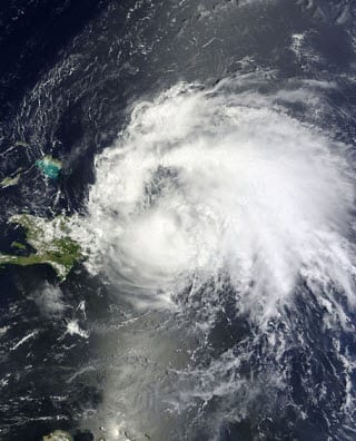
 The first major hurricane of the season has manifested in Irene, and it has been gaining strength as it surges toward the Bahamas. Weather trackers from the National Oceanic and Atmospheric Administration are predicting that Irene may make landfall as soon as Thursday. The hurricane has been growing in strength since its formation early Tuesday and has yet to show signs of slowing. Florida will be the first state that is hit by Irene should the hurricane reach the U.S., but both South Carolina and North Carolina will bear the brunt of the storm as it moves further north.
Catastrophe modeling company Eqecat, speaking to Reuters, said that the storm could be yet another disaster whose cost could range in the billions. According to NOAA’s forecast, Irene will be little more than a Category 1 hurricane when it makes landfall near Miami on Thursday. By the time it makes its way to the Carolinas, however, the hurricane will have matured into a Category 4. The sheer damage wrought by such a storm could shake an insurance industry that is already on unsure financial ground.
Insurers are now clamoring to shore up any excessive risks that might be present in the states that will be most affected by Irene. If the hurricane is as powerful as NOAA predicts – assuming that it does, in fact, reach land – the price of property and flood insurance could rise.
