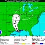
BOSTON, July 3, 2014 – According to catastrophe modeling firm AIR Worldwide, Arthur officially became a hurricane at about 5 a.m. EDT today… when maximum sustained winds of 75 mph and central pressure of 985 mb were reported by Hurricane Hunter aircraft and NOAA Doppler radar. At that time the storm was located some 190 miles (305 km) southwest of Cape Fear, North Carolina, but the track of the storm has since begun to shift a little to the northeast and its forward speed has increased slightly. According to the…
Read MoreTag: hurricane strength
Two Landfalls by Hurricane Isaac cause Severe Flooding in Louisiana: AIR
BOSTON, Aug. 29, 2012 – According to catastrophe modeling firm AIR Worldwide, by 7:00 AM CDT this morning (8:00 AM EDT), Isaac had made two separate landfalls, both as a Category 1 hurricane. The first occurred on August 28 at low-lying Plaquemines Parish, Louisiana, at around 7:45 PM CDT. Instead of continuing inland as expected, the storm veered sharply to the southwest and re-emerged over the water, which allowed it to maintain its strength. It then made a second landfall this morning just west of Port Fourchon, Louisiana, at around…
Read MoreHurricane Isaac on Course for Louisiana Landfall
BOSTON, Aug. 28, 2012 – According to catastrophe modeling firm AIR Worldwide, Isaac has finally reached hurricane strength. Isaac is a large tropical cyclone with maximum sustained winds of about 75 mph. It is located about 75 miles south-southeast of the mouth of the Mississippi River-a region that could benefit from the rain, as the prolonged hydrological drought this year has caused the river to drop to historic lows and ground cargo ships. Isaac is also about 160 miles to the south-southeast of New Orleans, and is moving slowly northwestward…
Read MoreIrene Becomes First Hurricane of the 2011 Atlantic Hurricane Season
According to catastrophe modeling firm AIR Worldwide, Irene became the Atlantic basin’s first hurricane of the 2011 season when its winds strengthened to 75 miles per hour at about 5:00 AM Monday morning as it was exiting Puerto Rico’s northern coast. Currently a Category 1 hurricane on the Saffir-Simpson Hurricane Wind Scale with sustained winds of 80 mph, Irene is expected to strengthen further over the next few days, potentially reaching Category 3 status by Saturday, depending on how long it remains over the ocean. “Hurricane Irene is the ninth…
Read MoreTropical Storm Bret Heads To Sea
BOSTON, July 18, 2011- According to catastrophe modeling firm AIR Worldwide, the second named storm of the 2011 Atlantic hurricane season, Tropical Storm Bret, formed off the coast of South Florida yesterday evening and is expected to strengthen to just below hurricane strength as it starts its turn toward the northeast. As of the National Hurricane Center’s 11:00 am EDT update today, Bret’s center is located about 60 miles north of the Great Abaco Island in the Bahamas. The storm is moving slowly north-northeast at 7 miles per hour with…
Read More


