BOSTON, Oct. 15, 2013 – According to catastrophe modeling firm AIR Worldwide, Tokyo is bracing itself for its strongest typhoon since October 2004. Wipha, the eighth typhoon of 2013 and the 26th named tropical cyclone of the year, is a huge storm system currently moving northeastward toward Japan. It will likely follow the coast and pass close to Tokyo around the morning rush hour on Wednesday, bringing with it powerful winds and heavy rain. According to the Japan Meteorological Agency (JMA), as of 14 UTC on October 15, Typhoon Wipha…
Read MoreTag: heavy rains
Cyclone Phailin Makes Landfall in Odisha, India
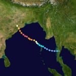
According to catastrophe modeling firm AIR Worldwide, Cyclone Phailin made landfall in the Indian state of Odisha at around 9:15 p.m local time on Saturday. The massive storm, at half the size of India according to satellite imagery, is the strongest to affect the country since 1999’s Cyclone Orissa, which killed nearly 10,000 people. Phailin is accompanied by strong winds, heavy rains, and damaging waves. Extensive property and crop damage is expected in the affected region. With power and communications cut off, damage information has been scarce overnight. A more…
Read MoreDowngraded Tropical Storm Ingrid Makes Landfall on Mexico’s East Coast: AIR Worldwide
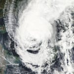
BOSTON, Sept. 16, 2013 – According to catastrophe modeling firm AIR Worldwide, Tropical Storm Ingrid had weakened from its Category 1 hurricane status by the time it made landfall near the small town of La Pesca on the eastern coast of Mexico between 6:00 and 7:00 a.m. CDT this morning. The National Hurricane Center’s 7:00 a.m. CDT Public Advisory reported that an Air Force Hurricane Hunter aircraft and radar imagery had confirmed that Ingrid had made landfall and that the storm’s wind speed had not increased in intensity as anticipated…
Read MoreTyphoon Sanba Makes Landfall in South Korea: AIR
According to catastrophe modeling firm AIR Worldwide, Typhoon Sanba made landfall on September 17 just before noon local time (3:00 UTC) in South Gyeongsang Province on the southern coast of South Korea. Maximum sustained winds at landfall were around 150 km/h (equivalent to a Category 1 hurricane on the Saffir-Simpson Scale). Sanba subjected both South and North Korea to winds and heavy rains in its north-northeast trek across the peninsula, causing flooding and landslides, transportation service disruptions, and power outages. Significant insured losses in South Korea are not expected from…
Read MoreIrene Becomes First Hurricane of the 2011 Atlantic Hurricane Season
According to catastrophe modeling firm AIR Worldwide, Irene became the Atlantic basin’s first hurricane of the 2011 season when its winds strengthened to 75 miles per hour at about 5:00 AM Monday morning as it was exiting Puerto Rico’s northern coast. Currently a Category 1 hurricane on the Saffir-Simpson Hurricane Wind Scale with sustained winds of 80 mph, Irene is expected to strengthen further over the next few days, potentially reaching Category 3 status by Saturday, depending on how long it remains over the ocean. “Hurricane Irene is the ninth…
Read More


